


Rungholt: Unearthing a Drowned Medieval Settlement in the Wadden Sea
The fabled town of Rungholt, often referred to as the "Atlantis of the North Sea," has long captivated historians and archaeologists. The town, part of the Edomsharde region in North Frisia, Germany, was devastated by a catastrophic storm flood in 1362 AD, known as the Grote Mandränke. Recent discoveries have shed light on this medieval settlement, offering insights into its thriving society and its sudden demise.
Rediscovering Rungholt: A Multi-Disciplinary Approach
A team of researchers from various institutions has undertaken a comprehensive study of the Rungholt area using state-of-the-art geophysical, geoarchaeological, and archaeological methods. Published in Nature: Scientific Reports, their work presents the first thorough reconstruction of this medieval settlement. The findings reveal up to 64 newly identified dwelling mounds, extensive drainage ditches, remnants of a sea dike, and most notably, the discovery of the Edomsharde’s main church—a significant landmark in the submerged cultural landscape.
- Sunken Sanctuary and Settlement Rediscovered on German Coast
- Grand Medieval Building Found Under Welsh Public Restrooms
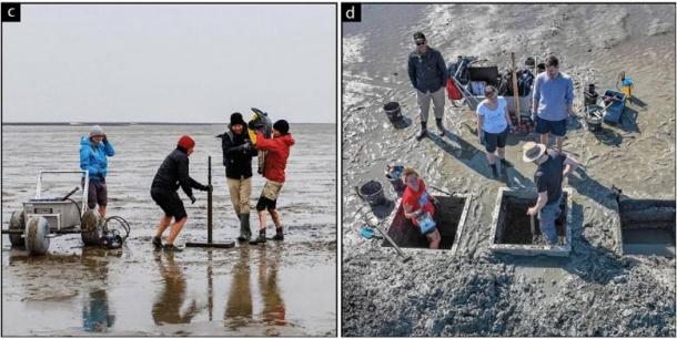
The researchers studying what they believe to be the lost medieval town of Rungholt. (F. Schlütz, Kiel; J. Lemm, Berlin/ Wilken et al./Nature)
The Impact of Human Intervention on the Landscape
The Wadden Sea, a UNESCO World Heritage Site, is renowned for its dynamic tidal flats, salt marshes, and fens. This region's landscape, stretching from the Netherlands to southern Denmark, was significantly altered by human activities during the medieval period. Efforts to reclaim low-lying coastal areas included constructing dikes, draining marshes, and extracting peat, which ultimately made these areas more vulnerable to flooding.
In the case of Rungholt, intensive human intervention transformed fertile marshlands into cultivated landscapes. However, these changes also led to subsidence and increased flood risks.
The 1362 AD storm flood, one of many during the Late Middle Ages, resulted in the permanent inundation of much of North Frisia, including Rungholt.
- Puzzling Stone Age Labyrinth Discovered in Denmark, What Was It Used For?
- The Surprising and Iconic Bronze Age Egtved Girl

Most common find categories of imported and high-quality objects have been found evenly distributed throughout the areas A, B and E. They include (from left to right, not to scale) imported lead-glazed redware and stoneware, cast bronze cauldrons, hammered brass cauldrons, swords and hispano-moresque faience (the last only in area B). (Wilken et al./Nature)
Key Findings: Buildings, Coins, and Pottery
The study's findings are based on the analysis of various artifacts and structures uncovered in the tidal flats surrounding the island of Hallig Südfall. The team used advanced geophysical techniques to identify and map the remains of medieval settlement structures. These included:
- Dwelling Mounds (Terps): Up to 64 terps were identified, suggesting a high settlement density. These artificial mounds provided elevated ground for buildings, protecting them from flooding.
- Drainage Ditches: An extensive network of drainage ditches was uncovered, indicating sophisticated water management systems used to reclaim and cultivate marshland.
- Seadike and Harbor: The remnants of a major seadike and associated harbor facilities highlight the region's maritime connections and the importance of coastal protection measures.
The most significant discovery was the foundation of the main church, a large rectangular structure with a semi-circular eastern end. This church likely served as the central ecclesiastical and administrative hub for the Edomsharde region.

Scan modeling of the Breklum church, and c) a reconstruction based on comparable buildings from the period. (Wilken et al./Nature)
A Thriving Medieval Society
The artifacts uncovered during the study paint a picture of a thriving medieval society engaged in transregional trade. Imported goods such as fine pottery, swords, and metal objects were found throughout the settlement area, indicating a prosperous community with strong trade connections. The presence of high-quality imported items suggests that Rungholt was not only an agricultural center but also a hub of economic activity in the North Sea region.
Implications for Medieval History
The discovery of Rungholt’s main church and the extensive settlement remains provide new insights into the region's medieval history. These findings confirm the existence of a well-organized, prosperous society that was deeply integrated into broader European trade networks. The detailed reconstruction of the Rungholt area also highlights the impact of human intervention on coastal landscapes and the long-term consequences of such actions.
Top image: The Rungholt settlement and investigation area. White dotted lines indicate the areas covered by magnetic gradiometry, the white dashed line outlines an area covered by marine seismic reflection profiles. Source: Wilken et al./Nature
